
About Uttarakhand, the "Land of the Gods"
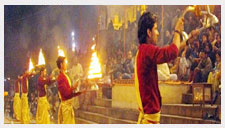
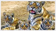
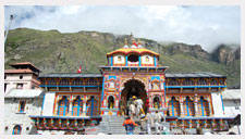
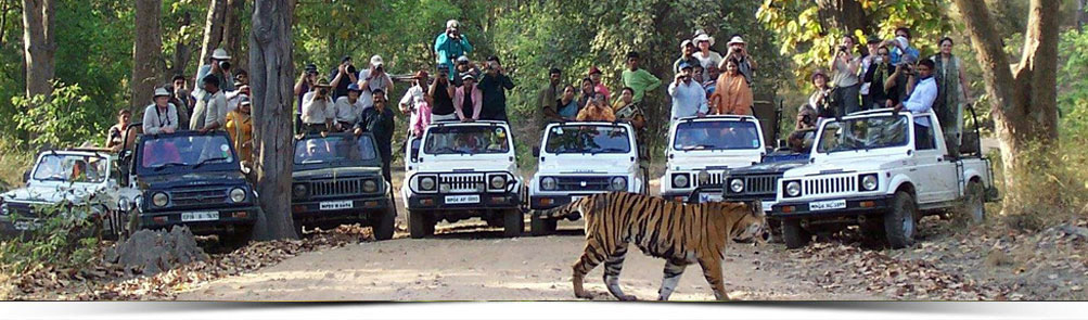
Uttarakhand is a state in the northern part of India. It is often referred to as the "Land of the Gods" due to the many holy Hindu temples and pilgrimage centres found throughout the state. Known for its natural beauty of the Himalayas, the Bhabhar and the Terai, the state was carved out of the Himalayan and adjoining northwestern districts of Uttar Pradesh on 9 November 2000, becoming the 27th state of the Republic of India. It borders the Tibet Autonomous Region on the north; the Mahakali Zone of the Far-Western Region, Nepal on the east; and the Indian states of Uttar Pradesh to the south and Himachal Pradesh to the northwest. The state is divided into two divisions, Garhwal and Kumaon, with a total of 13 districts. The provisional capital of Uttarakhand is Dehradun, which is also a railhead and the largest city in the region. The high court of the state is in Nainital. Archaeological evidence support the existence of humans in the region since prehistoric times. Among the first major dynasties of Garhwal and Kumaon were the Kunindas in the 2nd century BCE who practised an early form of Shaivism. Ashokan edicts at Kalsi show the early presence of Buddhism in this region. During the medieval period the region was consolidated under the Kumaon and Garhwal kingdom. By 1803 the region fell to the Gurkha Empire of Nepal and with the conclusion of the Anglo-Nepalese War in 1816 most of modern Uttarakhand was ceded to the British as part of the Treaty of Sugauli. Although the erstwhile hill kingdoms of Garhwal and Kumaon were traditional rivals, the proximity of different neighbouring ethnic groups and the inseparable and complementary nature of their geography, economy, culture, language, and traditions created strong bonds between the two regions which further strengthened during the movement for statehood in the 1990s. The natives of the state are generally called either Garhwali or Kumaoni depending on their place of origin. According to the 2011 census of India Uttarakhand has a population of 10,116,752, making it the 19th most populous state in India. A large portion of the population is Rajput and Brahmin. More than 88% of the population is Hindu. Muslims are the largest minority in the state with Sikhs, Christians, Buddhists, and Jains being the other major religions. Garhwali and Kumaoni are the two main regional languages with Hindi being the most widely spoken language. Two of the most important rivers in Hinduism originate in the region, the Ganga at Gangotri and the Yamuna at Yamunotri. These two along with Badrinath and Kedarnath form the Chota Char Dham, a holy pilgrimage for the Hindus. The state also hosts the Bengal tiger in Jim Corbett National Park, the oldest on the Indian subcontinent. There is also the Valley of Flowers, a Unesco World Heritage Site known for the variety and rarity of the flowers and plants found there.
History.
The historical temples at Jageshwar, preserved by the Archaeological Survey of India Ancient rock paintings, rock shelters, Paleolithic stone tools (hundreds of thousands of years old), and megaliths provide evidence that the mountains of the region have been inhabited since prehistoric times. There are also archaeological remains which show the existence of early Vedic (c. 1500 BCE) practices in the area. The Pauravas, Kushanas, Kunindas, Guptas, Gurjara-Pratihara, Katyuris, Raikas, Palas, Chands, Parmars or Panwars, Sikhs, and the British have ruled Uttarakhand in turns.[3] The region was originally settled by Kols, an aboriginal people of the austro-Asiatic physical type who were later joined by Indo-Aryan Khas tribes that arrived from the northwest by the Vedic period (1700–1100 BCE). At that time, present-day Uttarakhand also served as a haunt for Rishis and Sadhus. It is believed that the sage Vyasa scripted the Hindu epic Mahabharata in the state. Among the first major dynasties of Garhwal and Kumaon were the Kunindas in the 2nd century BCE who practised an early form of Shaivism and traded salt with Western Tibet. It is evident from the Ashokan edict at Kalsi in Western Garhwal that Buddhism made inroads in this region. Folk shamanic practices deviating from Hindu orthodoxy also persisted here. However, Garhwal and Kumaon were restored to nominal Brahmanical rule due to the travails of Shankaracharya and the arrival of migrants from the plains. Between the 4th and 14th centuries, the Katyuri dynasty dominated lands of varying extent from the Katyur (modern day Baijnath) valley in Kumaon. The historically significant temples at Jageshwar are believed to have been built by the Katyuris and later remodelled by the Chands. Other peoples of the Tibeto-Burman group known as Kiratas are thought to have settled in the northern highlands as well as in pockets throughout the region, and are believed to be ancestors of the modern day Bhotiya, Raji, Buksha, and Tharu peoples. Princely flag of Kingdom of Garhwal By the medieval period, the region was consolidated under the Garhwal Kingdom in the west and the Kumaon Kingdom in the east. The present king of Kumaon is Mahendra Chand of Lamakhet (Pithoragarh) he is married to Gita Chand of Rina and has three children (Aakanksha Chand, Mallika Chand, Aryan Chand) From the 13th to the 18th century, Kumaon prospered under the Chand monarchs who had their origins in the plains of India. During this period, learning and new forms of painting (the Pahari school of art) developed.[8] Modern-day Garhwal was likewise unified under the rule of Parmars who, along with many Brahmins and Rajputs, also arrived from the plains.[9] In 1791 the expanding Gurkha Empire of Nepal overran Almora, the seat of the Kumaon Kingdom. In 1803 the Garhwal Kingdom also fell to the Gurkhas. With the conclusion of the Anglo-Nepalese War in 1816, a rump portion of the Garhwal Kingdom was re-established from Tehri, and eastern Garhwal and Kumaon ceded to the British as part of the Treaty of Sugauli. Uttarakhand as a part of the United Province, 1903 After India attained independence from the British, the Garhwal Kingdom was merged into the state of Uttar Pradesh, where Uttarakhand composed the Garhwal and Kumaon Divisions.[10] Until 1998, Uttarakhand was the name most commonly used to refer to the region, as various political groups, including the Uttarakhand Kranti Dal (Uttarakhand Revolutionary Party), began agitating for separate statehood under its banner. Although the erstwhile hill kingdoms of Garhwal and Kumaon were traditional rivals the inseparable and complementary nature of their geography, economy, culture, language, and traditions created strong bonds between the two regions.[11] These bonds formed the basis of the new political identity of Uttarakhand, which gained significant momentum in 1994, when demand for separate statehood achieved almost unanimous acceptance among both the local populace and national political parties.[12] The most notable incident during this period was the Rampur Tiraha firing case on the night of 1 October 1994, which led to a public uproar.[13] On 24 September 1998, the Uttar Pradesh Legislative Assembly passed the Uttar Pradesh Reorganisation Bill, which began the process of creating a new state.[14] Two years later the Parliament of India passed the Uttar Pradesh Reorganisation Act 2000, and thus, on 9 November 2000, Uttarakhand became the 27th state of the Republic of India. "Maatu hamru, paani hamru, hamra hi chhan yi baun bhi... Pitron na lagai baun, hamunahi ta bachon bhi" Soil ours, water ours, ours are these forests. Our forefathers raised them, it’s we who must protect them. Old Chipko Song (Garhwali language) Uttarakhand is also well known for the mass agitation of the 1990s that led to the formation of the Chipko environmental movement[16] and other social movements. Though primarily a livelihood movement rather than a forest conservation movement, it went on to become a rallying point for many future environmentalists, environmental protests, and movements the world over and created a precedent for non-violent protest.[17] It stirred up the existing civil society in India, which began to address the issues of tribal and marginalized people. So much so that, a quarter of a century later, India Today mentioned the people behind the "forest satyagraha" of the Chipko movement as amongst "100 people who shaped India".[18] One of Chipko's most salient features was the mass participation of female villagers.[19] Both female and male activists played pivotal roles in the movement, including Chandi Prasad Bhatt]], Sundarlal Bahuguna, and Ghanasyam Raturi, the popular Chipko poet.
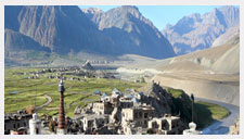
Geography
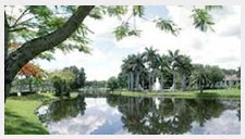
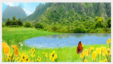
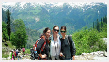
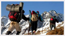
Nanda Devi, the second-highest mountain in India Uttarakhand has a total area of 53,566 km², of which 93% is mountainous and 64% is covered by forest. Most of the northern part of the state is covered by high Himalayan peaks and glaciers, while the lower foothills were densely forested till logged by British log merchants and, after independence, by forest contractors. Recent efforts in reforestation, however, have begun to restore the historical environment. The Himalayan ecosystem provides habitat for many animals (including bharal, snow leopards, leopards and tigers), plants, and rare herbs. Two of India's largest rivers, the Ganges and the Yamuna, originate in the glaciers of Uttarakhand, where they are fed by myriad lakes, glacial melts and streams. Uttarakhand lies on the southern slope of the Himalaya range, and the climate and vegetation vary greatly with elevation, from glaciers at the highest elevations to subtropical forests at the lower elevations. The highest elevations are covered by ice and bare rock. Below them, between 3,000 and 5,000 metres (9,800 and 16,000 ft) are the western Himalayan alpine shrub and meadows. The temperate western Himalayan subalpine conifer forests grow just below the tree line. At 3,000 to 2,600 metres (9,800 to 8,500 ft) elevation they transition to the temperate western Himalayan broadleaf forests, which lie in a belt from 2,600 to 1,500 metres (8,500 to 4,900 ft) elevation. Below 1,500 metres (4,900 ft) elevation lie the Himalayan subtropical pine forests. The Upper Gangetic Plains moist deciduous forests and the drier Terai-Duar savanna and grasslands cover the lowlands along the Uttar Pradesh border in a belt locally known as Bhabhar. These lowland forests have mostly been cleared for agriculture, but a few pockets remain.
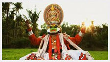
Uttarakhand Culture
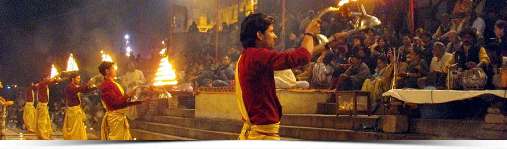
The state of Uttarakhand is not only popular with tourists for its scenic landscapes and natural beauty. It's also visited by travellers because of its cultural richness. During your visit to Uttarakhand, you'll find it truly enriching exploring the different cultural shades. Whether you talk about the state's fairs and festivals, music, dance forms, cuisine or the lifestyle of people, the richness of cultural will catch your eye almost immediately. Experiencing the cultural traditions of a place is the biggest joy for travellers. Though the majority of people in the state belong to Hinduism, the state is home to several ethnic groups. Each of these groups have some unique to offer the traveler in terms of customs and traditions. MUSIC & DANCE FORMS Music and dances are an integral part of Uttarakhand's culture. One of the biggest attractions for tourists is the folk music that you can listen to during religious and regional festivals. Whether it's the Kumaon region or the Garhwal region (Garhwali Dance), you can have a great time taking joy from some of the most wonderful musical tunes and lyrics.Popular folk songs in the state include Mandals, Panwaras, Thadya and Jhoda among others. The bygone years have given rise to multiple noted musicians as well. Over the years, the various musical forms have also undergone changes.Like folk songs, folk dance is also a major crowd puller in the state. During the festive season, you can visit different cities and towns of the state to enjoy seeing different types of folk dance forms. Langvir Nritya and Brada Nati are very popular traditional dance forms.